Placing the power of sea level rise analysis at the fingertips of in situ resource managers, planners, and scientists
Few development frameworks possess the means to rapidly produce complex applications like SLAMM-View, which enables studying the effects of sea-level rise on our precious coastal watersheds, nurseries, and wildlife sanctuaries. Image Matters’ state-of-the-art userSmarts® open-source platform made it possible to build the first SLAMM-View prototype in less than one week. The means to handle multiple, linked sea level simulations and conduct real-time comparative analyses-on-demand are two capabilities that most frameworks simply don’t provide.
Assessing the impact of sea level rise into the future
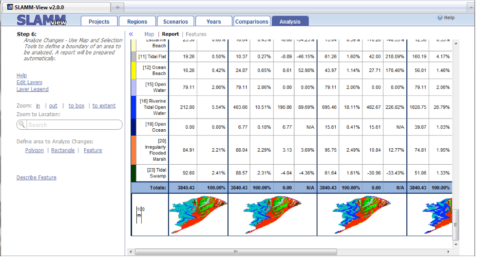
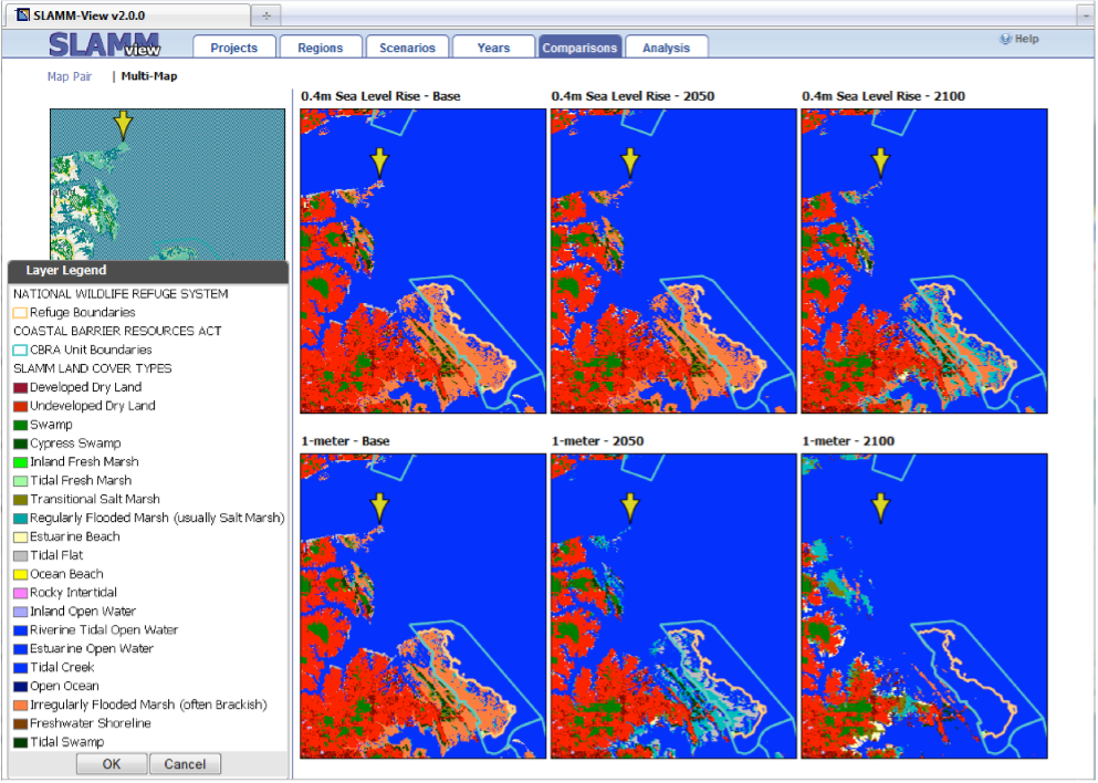
SLAMM-View is a web application that provides advanced tools for improving our understanding of the impact of sea level rise, by employing simulation results from the Sea Level Affecting Marshes Model (SLAMM). SLAMM-View was designed for a user-friendly, workflow-based approach to assess impacts of sea level rise on wetlands of coastal areas with both visualization and analysis functionality. SLAMM-View provides simultaneous comparison between both current and future conditions out to the year 2100, and among different sea level rise scenarios (e.g., 0.4 meter vs. 1 meter). Its multi-map view provides the simultaneous comparison of SLAMM simulation results through time and between different scenarios. Its analysis tools report the projected changes in sea level by SLAMM cover class across each scenario timeline.